← Back to Bojnice
Bojnice / Upper Nitra

Day trips near Bojnice.

Browse the map, choose an interest or search for a place. Find photographs, stories and practical tips below.

Beyond Bojnice / Upper Nitra and nearby

Beautiful places nearby.
Another reason to stay.

Rocky viewpoints, mountain summits, historic monuments and quiet waterside spots. Choose your next outing and discover the region through photographs and stories on codnes.sk.

Straight-line distance from Bojnice Castle

These are not walking or driving distances. Places without a verified location appear when All distances is selected.

Nájdené miesta: 31

Choose a route that suits your fitness, the weather and current access conditions.

Find your next outing on the map

Where will you go from Bojnice?

The filters and search above also update the map. Select a marker to discover more.

Loading map…

Markers show a place or area, rather than necessarily a car park or trailhead. Check access in the place details.

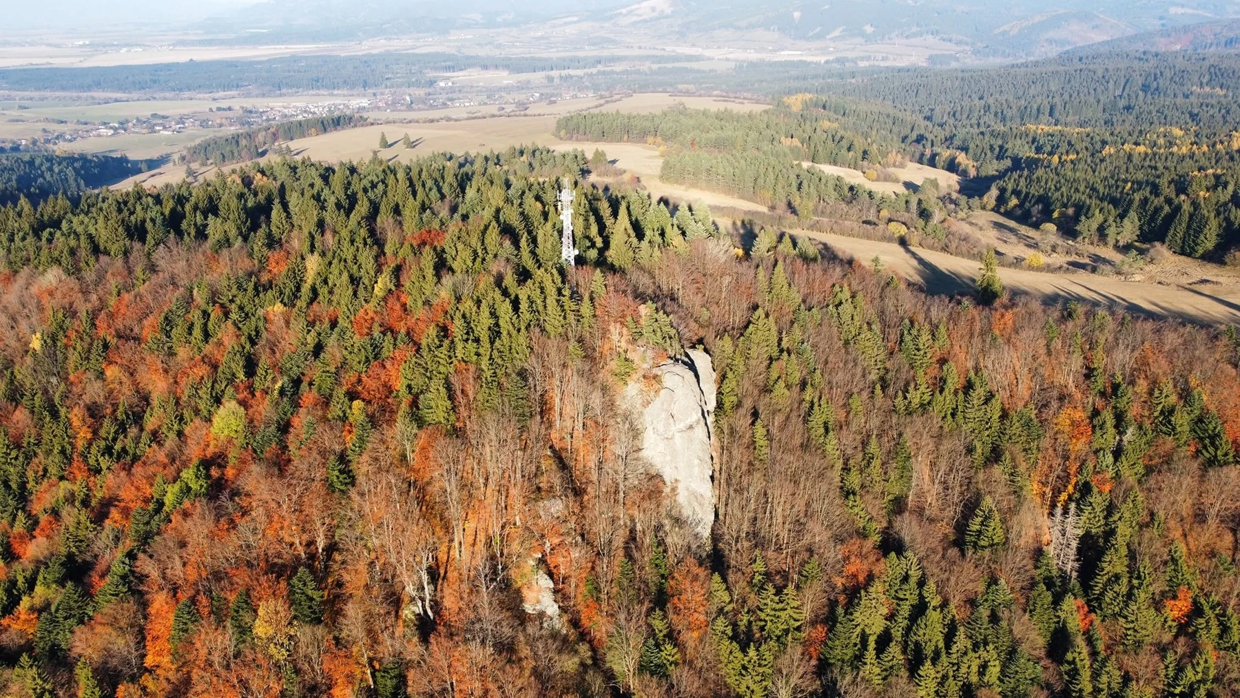
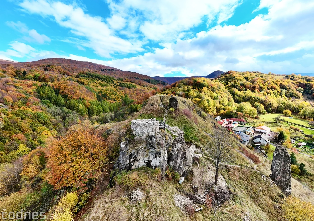
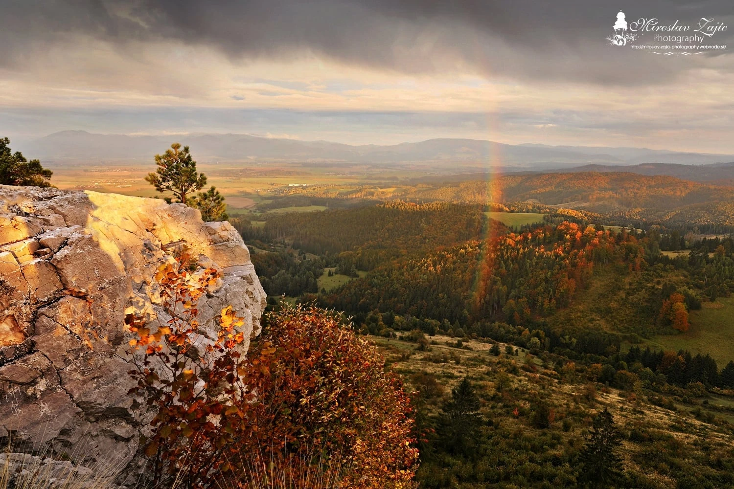
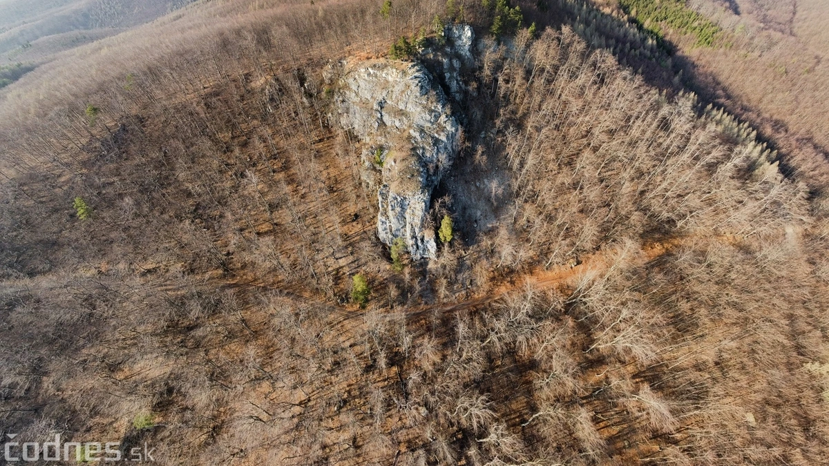
Bralová skala and autumn forests from above
Photo: codnes.sk (Slovak)
Remata / Ráztočno

Bralová skala

≈ 17.3 km · straight-line distance from the castle

Explore the Remata area on the Remata–Ráztočno nature trail. Its route takes in Bralová skala and the surrounding meadows.

Find the route and stops in the town of Handlová's nature trail guide.

Natural cliff edges without railings
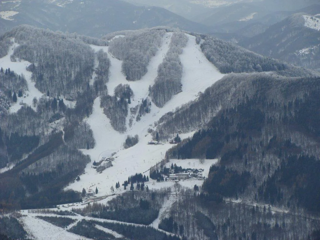
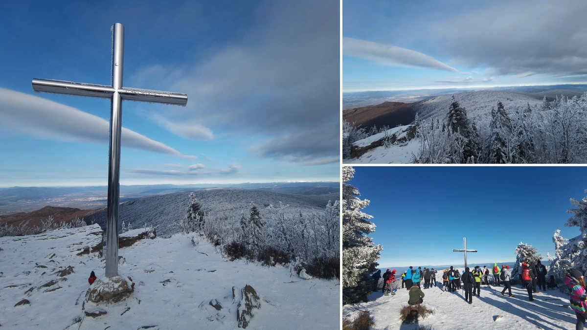
Collage of winter views, the summit cross and hikers on Vtáčnik
Photo: codnes.sk (Slovak)
Highest summit in the range / 1,346 m

Vtáčnik

≈ 17.8 km · straight-line distance from the castle

Head into the Vtáčnik Mountains. Archived hiking trips on codnes.sk offer inspiration; plan your own route according to your fitness and the weather.

Choose your start point and return time using an up-to-date hiking map.

Longer mountain hike · allow for elevation gain
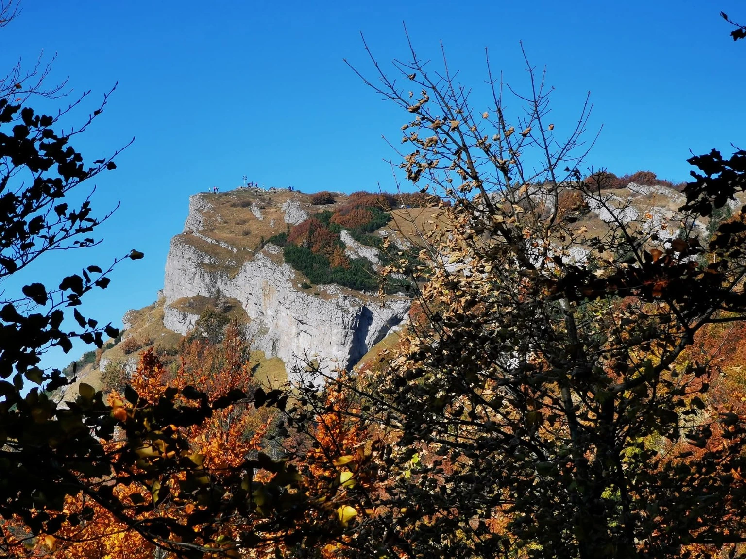
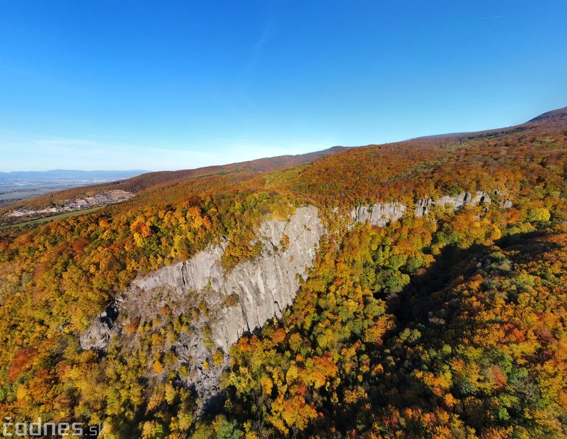
Autumn view of Hrádok's andesite cliffs
Photo: codnes.sk / 2021 archive (Slovak)
Bystričianska Valley / Vtáčnik Mountains

Hrádok

≈ 15.7 km · straight-line distance from the castle

A massive andesite wall, a wooded valley and a place with a long climbing tradition. Discover its autumn atmosphere in the photo report.

Depending on the route, start from Bystričany or Kamenec pod Vtáčnikom.

Hiking and climbing are different activities; climbing requires equipment and experience.
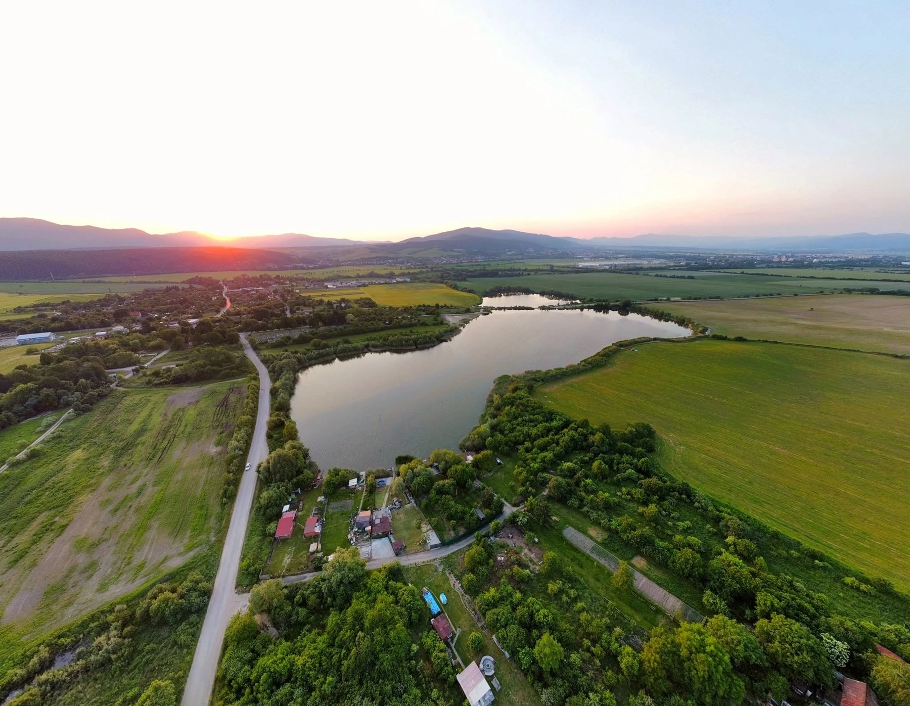
Koš lakes at sunset from above
Photo: codnes.sk (Slovak)
Koš / Upper Nitra Basin

Košovské jazerá lakes

≈ 3.9 km · straight-line distance from the castle

Lakes and wetlands important to the birds and wildlife of Upper Nitra. A place to observe the landscape quietly and understand its changes.

Near the village of Koš; check access according to local conditions.

Wetlands · quiet observation from accessible paths
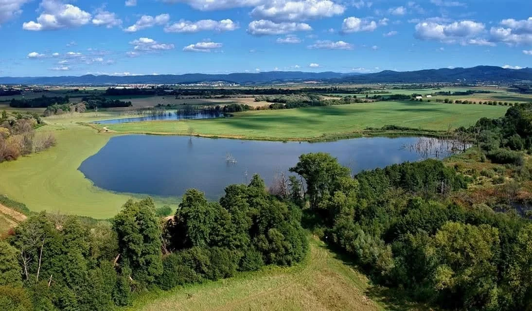
Laskár lake and surrounding wetlands from above
Photo: codnes.sk (Slovak)
Laskár / near Nováky

Laskár lake

≈ 5.3 km · straight-line distance from the castle

Another waterside location in Upper Nitra. An archived codnes.sk report introduces the Laskár wetlands together with the Koš lakes.

Laskár area; check shoreline access and local conditions on arrival.

Natural area · respect birdlife and access restrictions
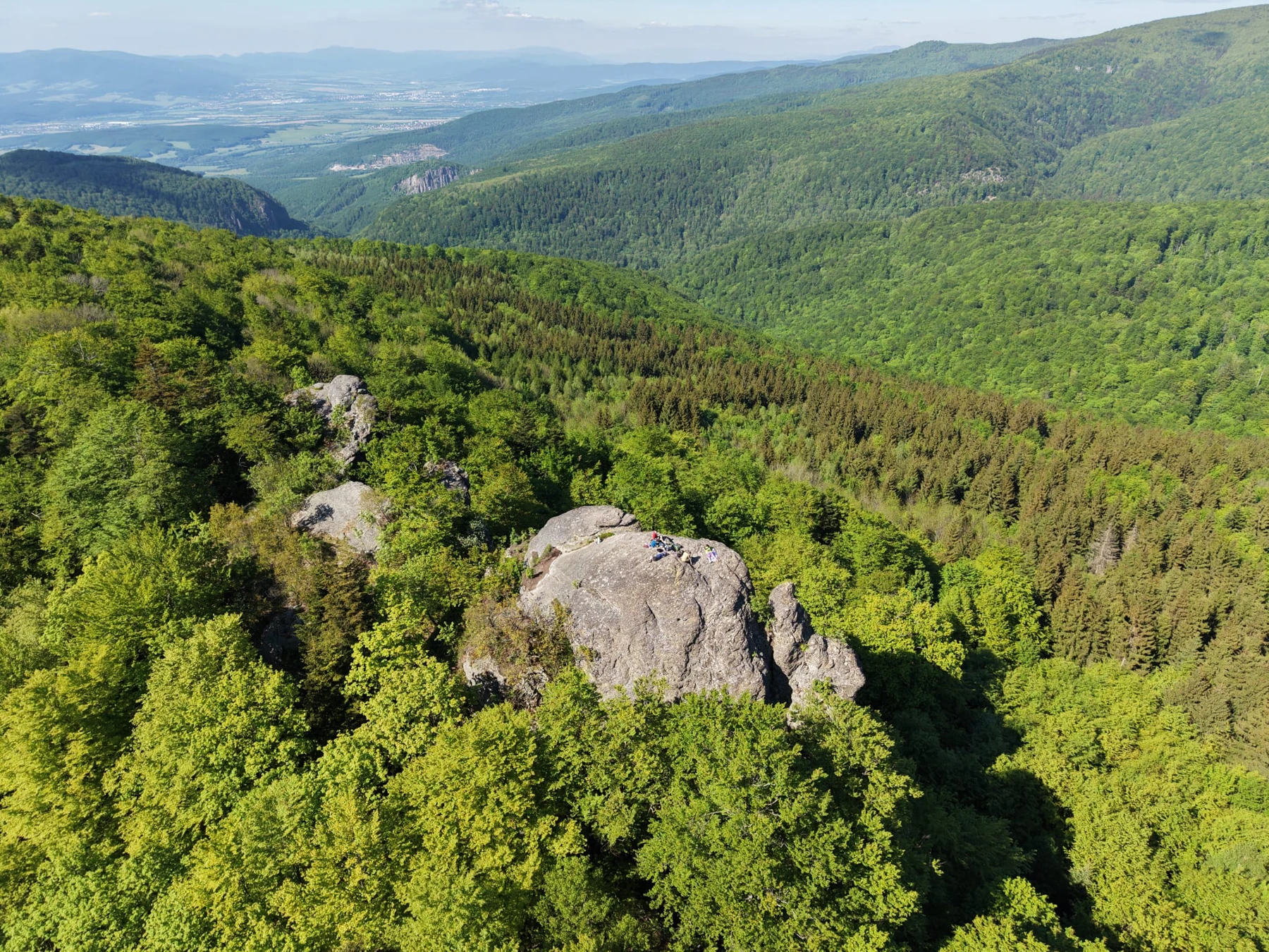
Žarnov's rocky summit and views over Upper Nitra
Photo: codnes.sk (Slovak)
Vtáčnik Mountains / Ponitrie Protected Landscape Area

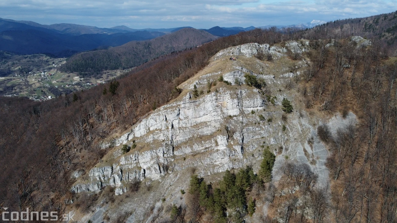
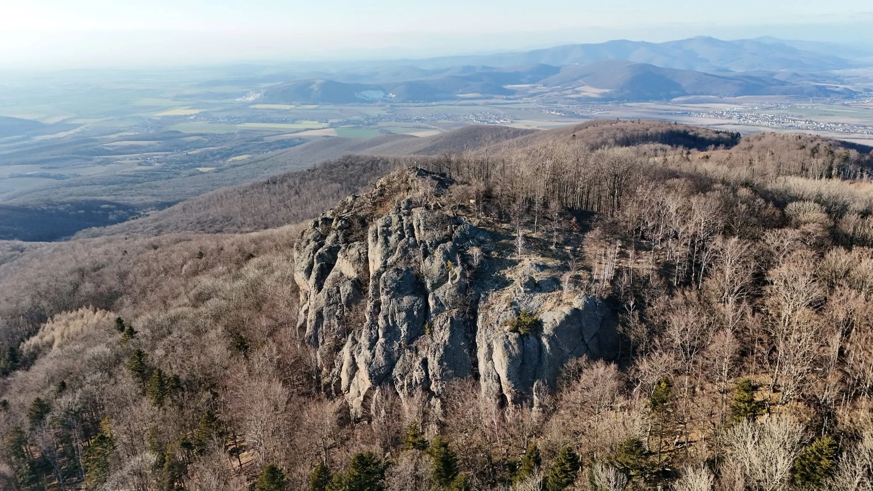
Žarnov

≈ 19.2 km · straight-line distance from the castle

This rocky summit in the Vtáčnik Mountains is another idea for a hike. Discover it through the codnes.sk photo gallery.

Plan your approach along marked trails; Žarnov is on the Buchlov nature trail.

Mountain and rocky terrain · hiking footwear
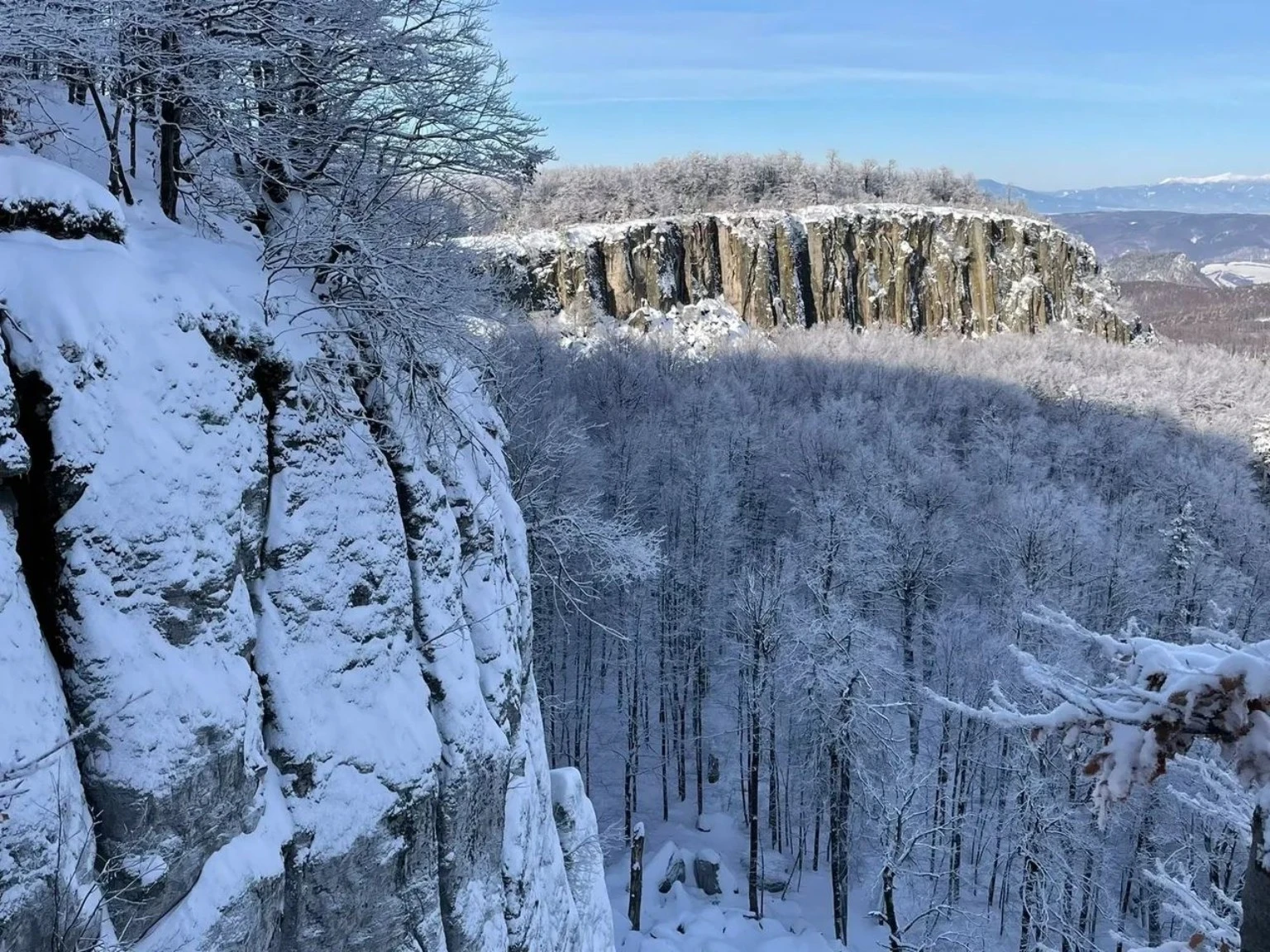
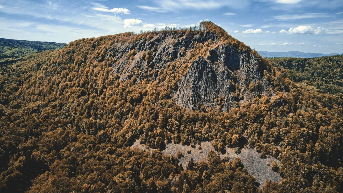
Snow-covered cliffs of Biely kameň and the surrounding forests
Photo: codnes.sk (Slovak)
Vtáčnik Mountains / near Handlová

Biely kameň

≈ 12.8 km · straight-line distance from the castle

This prominent outcrop, also known as Biela skala, is surrounded by forests in the north-eastern Vtáčnik Mountains. The codnes.sk photo gallery captures its winter atmosphere.

Plan with a current hiking map and keep to marked paths.

Nature reserve · respect protected land and keep clear of unstable cliff edges.
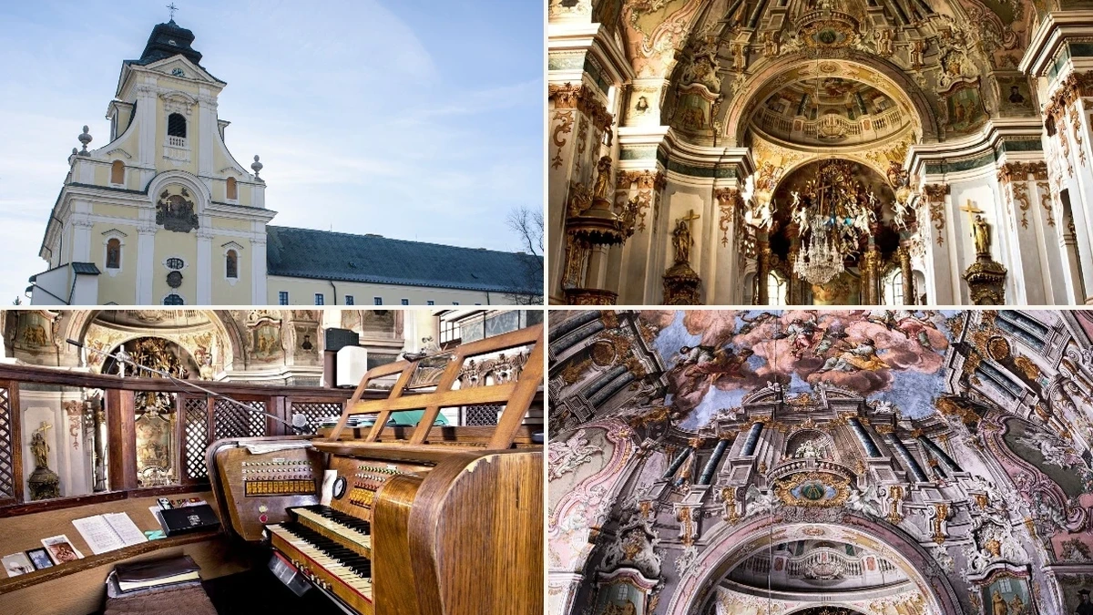
Collage of the exterior, Baroque interior and organ of Prievidza's Piarist Church
Photo: Miroslav Zajic / codnes.sk archive (Slovak)
Prievidza / historic centre

Piarist Church in Prievidza

≈ 3.3 km · straight-line distance from the castle

A richly decorated Baroque church with a crypt where members of the religious order are buried. Discover its stories and the return of casts of historic statues to its façade in photographs and videos on codnes.sk.

Check access to the interior and any guided tours in advance.

Historic religious monument · respect church services
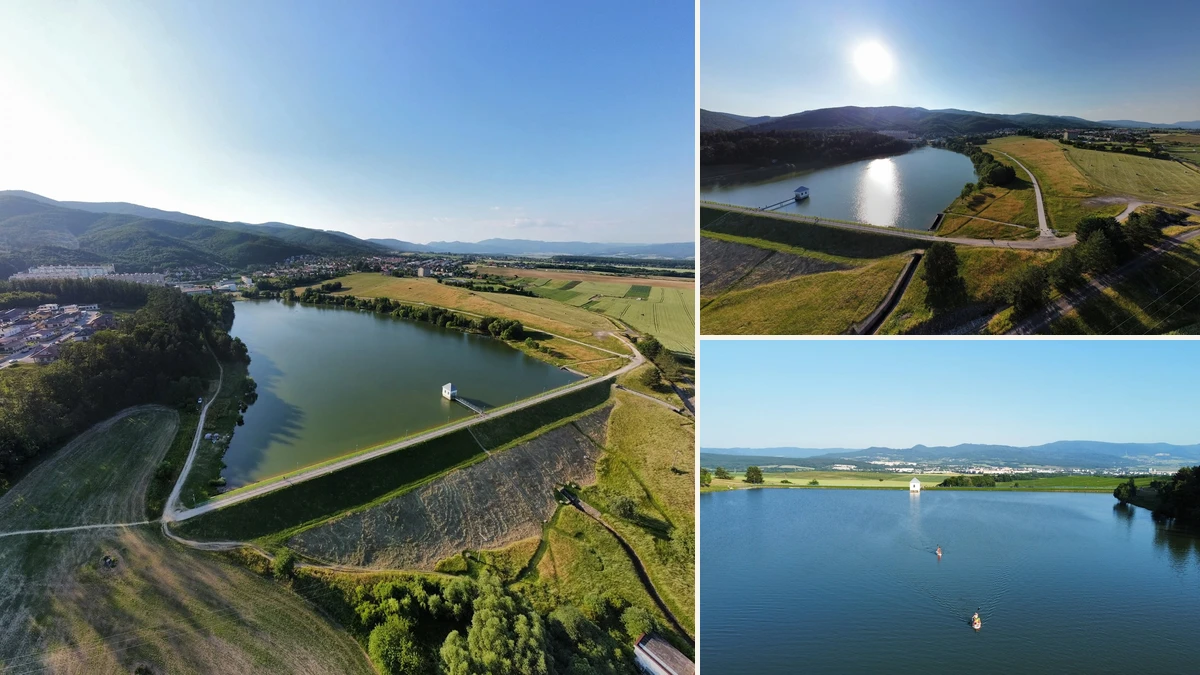
Collage of aerial and summer views of Kanianka Reservoir
Photo: codnes.sk (Slovak)
Kanianka / near Bojnice

Kanianka Reservoir

≈ 3.5 km · straight-line distance from the castle

The reservoir near Kanianka is an idea for a waterside walk and a restful break. Summer aerial views show its banks and surroundings. In past winters, the frozen reservoir has also attracted skaters.

Travel to Kanianka and continue to the reservoir along accessible paths.

Skating depends on safe natural ice; archived photographs do not confirm present conditions.
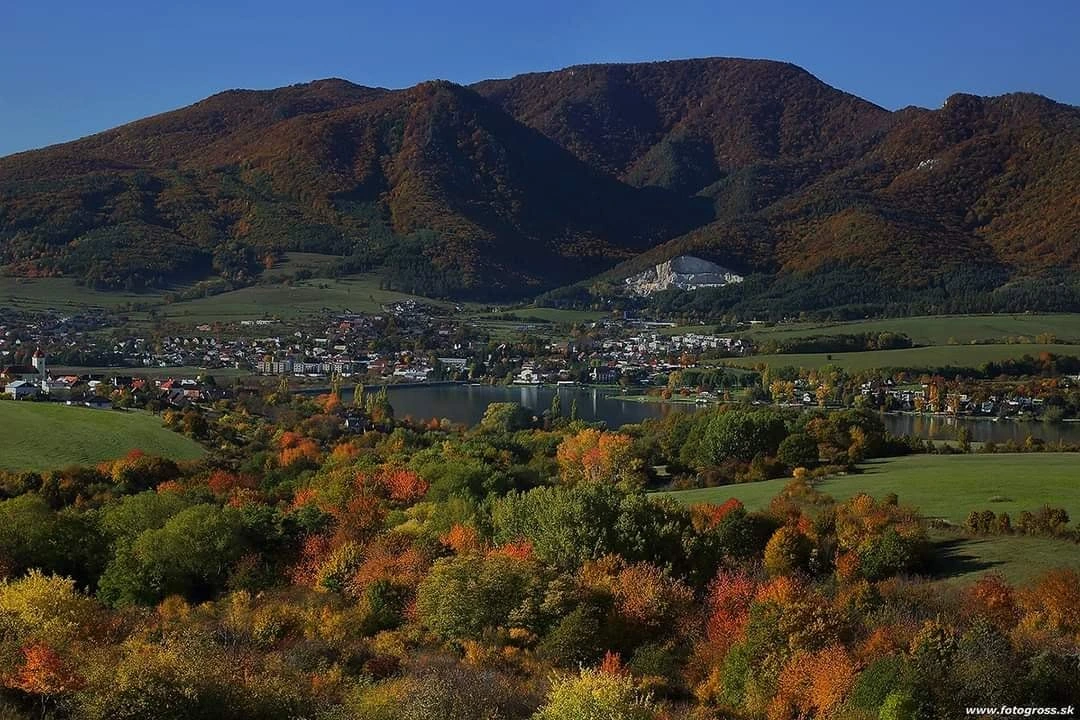
Autumn landscape and Nitrianske Rudno Reservoir beneath the mountains
Photo: fotogross.sk
Nitrianske Rudno / Nitrica River

Nitrianske Rudno Reservoir

≈ 7.7 km · straight-line distance from the castle

The reservoir on the Nitrica River offers waterside relaxation and views of the surrounding hills. It is one of Upper Nitra's summer recreation areas.

Travel to Nitrianske Rudno and choose shoreline access according to local conditions.

Check available services and recreation conditions before visiting.
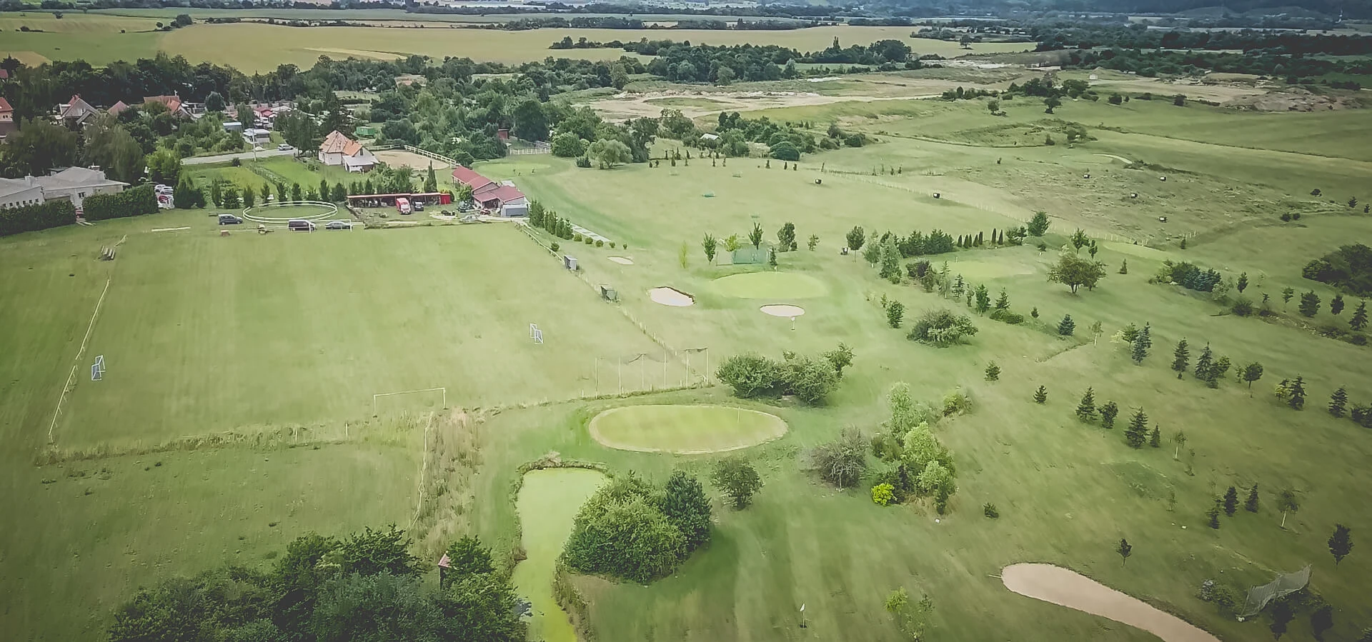
Agama Golf Klub course in Koš
Photo from the Agama Golf Klub profile on codnes.sk (Slovak)
Koš / Nová 113

Agama Golf Klub – Koš

≈ 4.6 km · straight-line distance from the castle

The golf course in Koš is an option for an active break near Bojnice and Prievidza. Its codnes.sk profile introduces the club, facilities and events.

On Nová Street in Koš; check visits, bookings and beginner options directly with the club.

Golf and leisure · services depend on the club's current offer
Autumn view of Vyšehrad in the Žiar Mountains
Photo: Miroslav Zajíc / codnes.sk (Slovak)
Žiar Mountains / above Nitrianske Pravno

Vyšehrad

≈ 13.9 km · straight-line distance from the castle

Vyšehrad combines views from the Žiar Mountains with the story of an ancient hillfort. Its summit and surroundings bring nature together with archaeological traces of settlement from several periods.

Follow the red-marked trail from Vyšehradské sedlo; the final section is steeper.

Hiking · views · historic hillfort
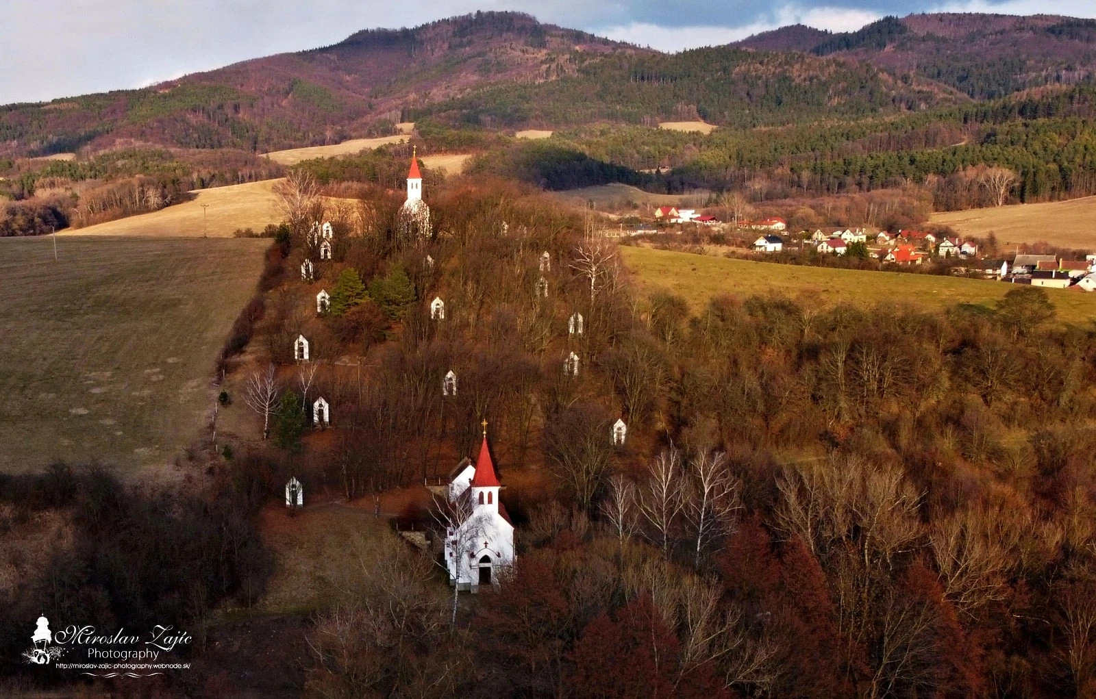
Solka Calvary above Nitrianske Pravno
Photo: Miroslav Zajíc / codnes.sk (Slovak)
Nitrianske Pravno / Solka

Solka Calvary

≈ 11.4 km · straight-line distance from the castle

The calvary above Solka offers a walk between chapels and views over the Upper Nitra Basin. Its 27 religious structures were built between 1934 and 1937 and form a national cultural monument.

Walk from the foot of the calvary between Nitrianske Pravno and its Solka district.

Religious heritage · walking · views
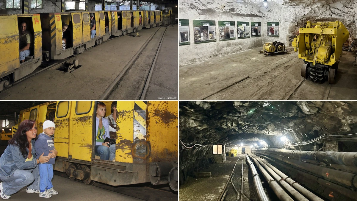
Photo collage of the Upper Nitra Mining Open-Air Museum in Handlová
Source: codnes.sk · fotogross.sk (Slovak)
Handlová / Štrajková 1779/1

Upper Nitra Mining Open-Air Museum, Handlová

≈ 14.0 km · straight-line distance from the castle

Board a mining train into the authentic underground workings of a former lignite mine. The approximately 2.5 km journey is followed by a guided walk through mining spaces and machinery, bringing Upper Nitra’s industrial heritage and miners’ work to life.

Arrange your tour in advance. Check the date, price, clothing requirements and conditions for children with the operator.

Mining history · train ride · advance booking
Aerial view of Hájska skala above Ráztočno
Photo: codnes.sk (Slovak)
Ráztočno / Žiar Mountains

Hájska skala

≈ 14.7 km · straight-line distance from the castle

This striking outcrop above Ráztočno overlooks the Handlová Valley and surrounding mountains. Combine the hike with a stop at Hájska Cave below the rock. Explore the location in photographs and video on codnes.sk.

Follow the blue-marked trail from Ráztočno railway station, through meadow and forest; some sections are steeper.

Rocky viewpoint · hiking · cave below the cliff
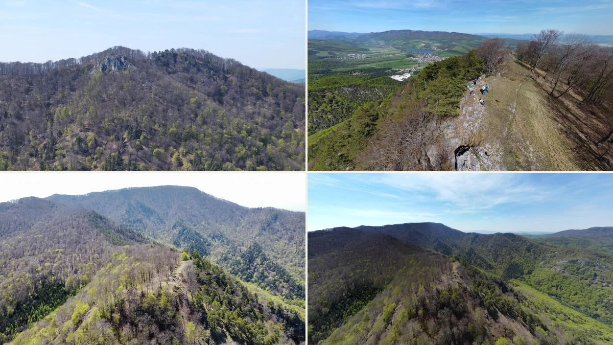
Four-photo collage of Rokoš: rocky ridges, forests and views into the Rudno Valley
Photo: codnes.sk (Slovak)
Strážovské Mountains / above Rudno Valley

Rokoš

≈ 10.5 km · straight-line distance from the castle

At 1,010 metres, Rokoš is a prominent summit above the Rudno Valley. A hike combines forests, rocky sections and viewpoints around the massif. The codnes.sk photo gallery follows a ridge walk via Predný Rokoš, Plevňa, Rokoš and Košútova skala.

Start from Ješkova Ves. The loop in the photo gallery is around 12 km; adapt the distance and elevation gain to your fitness.

Mountain hike · ridge walk · marked paths in a nature reserve
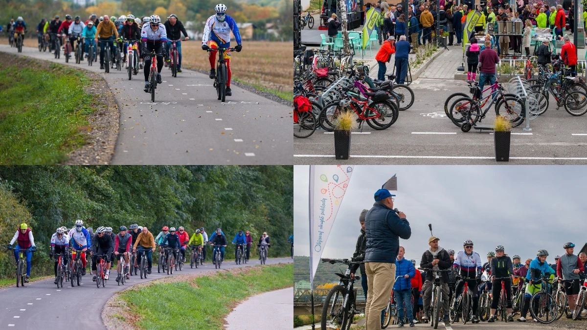
Cyclists at the opening of the Partizánske–Chalmová section of the Upper Nitra Cycle Route
Photo: ABO Photography · source: codnes.sk (Slovak)
Partizánske / Chalmová, Bystričany

Upper Nitra Cycle Route – Partizánske to Chalmová

≈ 13.4 km · straight-line distance from the castle

A 10.2 km cycling outing beside the Nitra River on the Upper Nitra Cycle Route. It connects Partizánske with the thermal swimming pool in Chalmová, with a cycling rest stop along the way. The photo report captures its opening in October 2026.

Start near Koliba Dolina in Partizánske or at the swimming pool in Chalmová. The route also uses local roads. There is not yet a continuous cycle-route connection from Bojnice; plan transport to your starting point separately.

Cycling outing · 10.2 km one way · wider Bojnice area
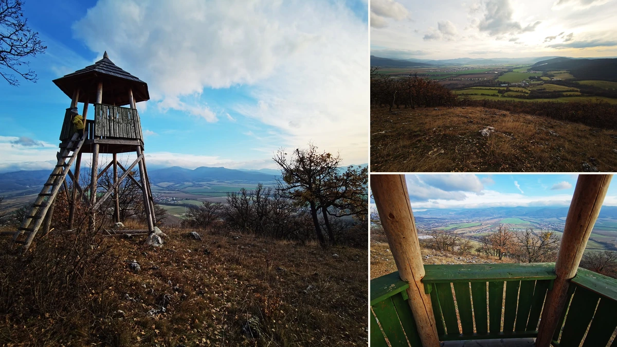
Collage of Malý Ľubín viewing tower, autumn scenery and the view from the wooden platform
Photo: codnes.sk (Slovak)
Chalmová / Bystričany / Strážovské Mountains

Malý Ľubín viewing tower

≈ 13.4 km · straight-line distance from the castle

A wooden viewing tower above Chalmová overlooks the Upper Nitra Basin and surrounding hills. It is part of a forestry nature trail exploring local nature and history. The codnes.sk gallery captures the tower and autumn landscape; maps also list the place as Malý Lubín.

Start at Chalmová thermal swimming pool. The full nature trail loop is approximately 6.4 km with 278 m of elevation gain and takes around 2.5 hours, including a detour to the tower. A ladder leads up to the viewing platform.

Viewing tower · moderately demanding walking loop · no cycling between the swimming pool and tower
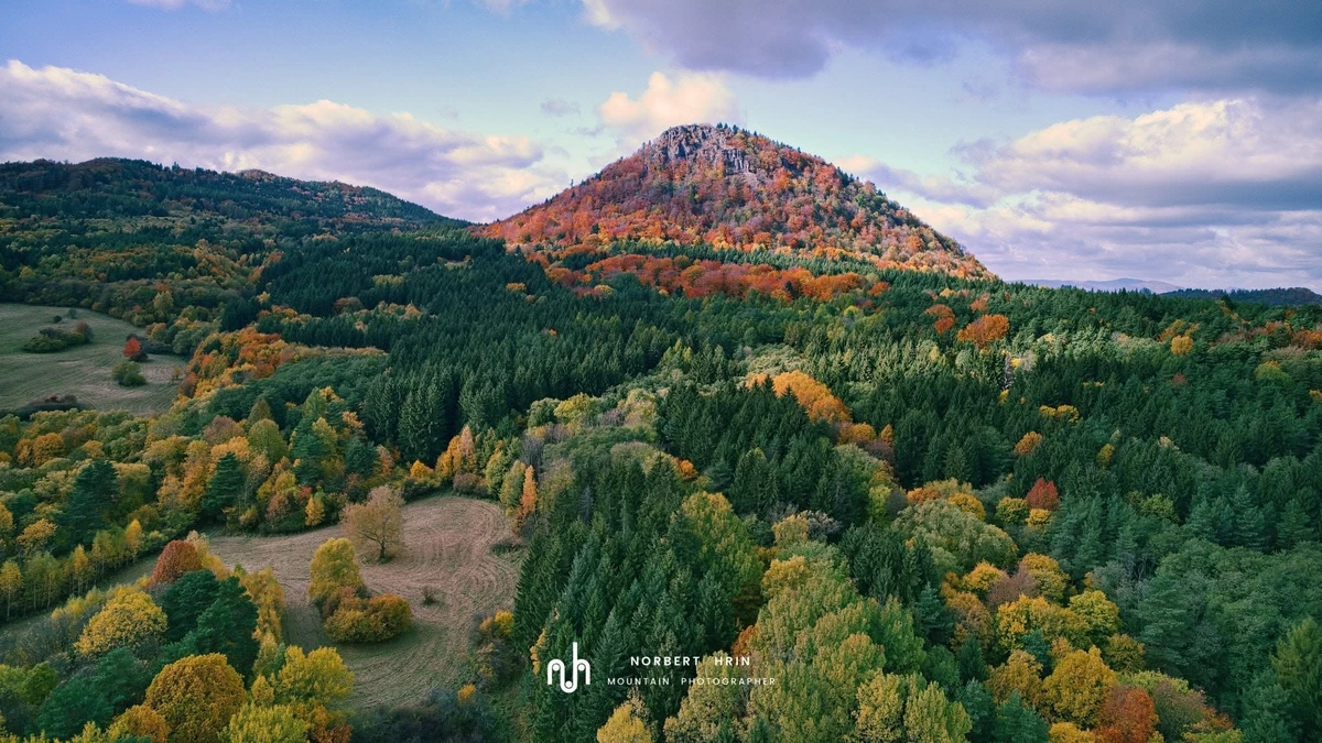
Veľký Gríč above Handlová with its towering rock face and autumn forests
Photo: Norbert Hriň
Handlová / Vtáčnik Mountains

Veľký Gríč

≈ 12.5 km · straight-line distance from the castle

A prominent andesite crag above Handlová, with a rocky summit, forests and views over the Handlová Basin. Also spelt Veľký Grič on maps, it features in a 2021 codnes.sk article about its inclusion in the Primeval Forests of Slovakia reserves.

Follow the red-marked trail from Námestie baníkov in Handlová. Plan for your fitness and the weather; the town guide suggests around 5 hours for the return hike.

Mountain hike · rocky viewpoints · keep to marked trails
Malý Gríč rising above colourful autumn forests, photograph by Norbert Hriň
Photo: Norbert Hriň
Handlová / Vtáčnik Mountains

Malý Gríč

≈ 11.3 km · straight-line distance from the castle

This rocky summit above Handlová is another hiking destination in the Vtáčnik Mountains. A woodland climb leads to views from the crag; hiking maps also spell its name Malý Grič. The neighbouring Veľký Gríč offers the option of extending your outing to a second summit.

Follow the green-marked trail from Námestie baníkov in Handlová to Tri studničky, then the yellow trail to the summit. A rocky section below the top is equipped with chains; the town guide suggests around 5 hours for the return hike.

Mountain hike · rocky final section with chains · sturdy hiking footwear
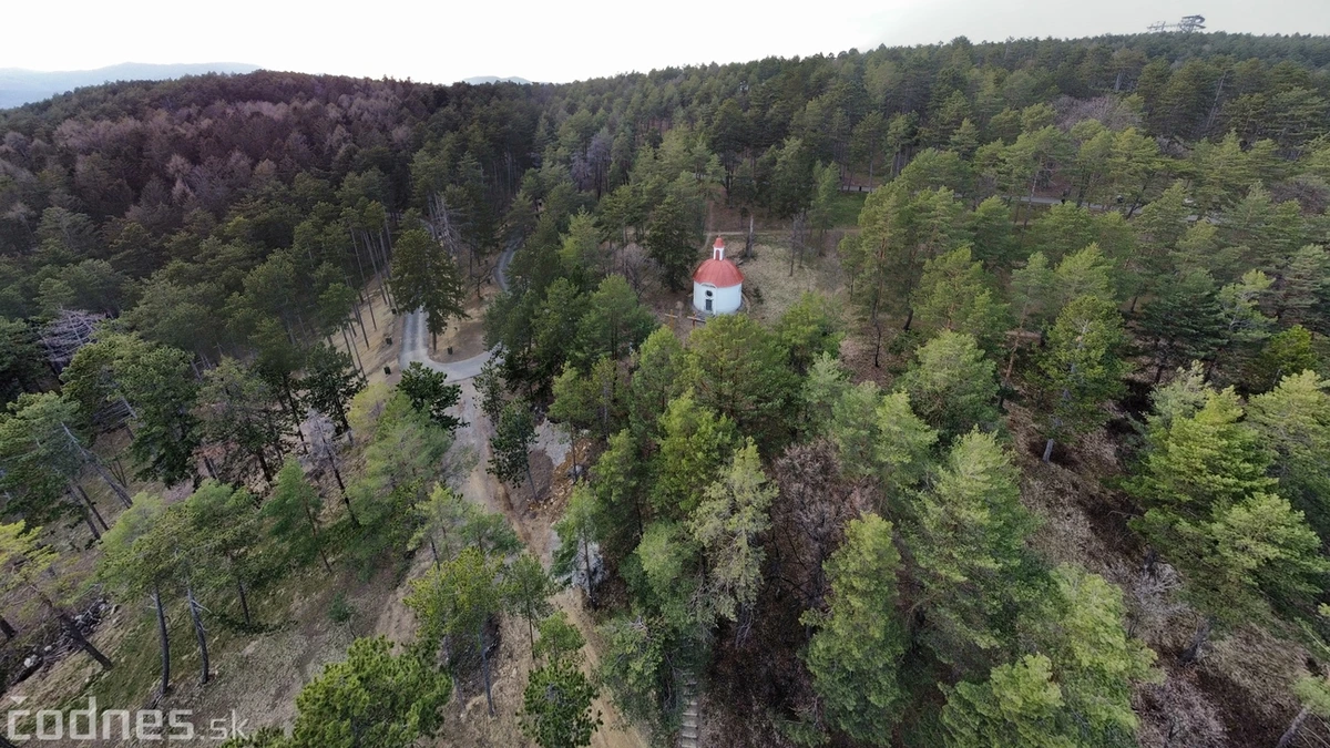
Aerial view of the Chapel of Our Lady of Sorrows at Bojnice Calvary surrounded by woodland
Photo: codnes.sk (Slovak)
Bojnice / forest above town

Bojnice Calvary

≈ 1.0 km · straight-line distance from the castle

A woodland walk past six Stations of the Cross leads to the Chapel of Our Lady of Sorrows and a group of three crosses. On the slope of Predné Štefanovo, the calvary brings together religious architecture and pine woodland. A codnes.sk photo report captures its atmosphere.

Walk from Bojnice to the start of the Stations of the Cross near the road out towards Šútovce, then follow the woodland path and stone steps up to the chapel. Wear sturdy footwear; the chapel interior may not be open.

Religious heritage · woodland walk · steps and uphill sections
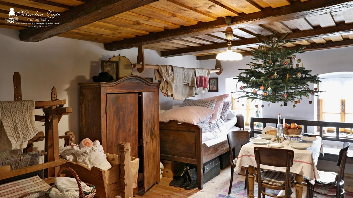
A traditionally furnished room in Zvonárike dom in Lazany, with a Christmas tree suspended above the table
Photo: Miroslav Zajíc / codnes.sk (Slovak)
Lazany / folk traditions

Zvonárike dom

Distance not yet determined

A small village museum in the restored home of a former bell-ringer explores traditional life in Lazany. The Sielnica association preserves period room and kitchen furnishings, folk dress and weaving displays. The photo gallery shows the interior decorated for Christmas.

Arrange an interior visit in advance by calling +421 907 734 905. The house is in the old part of Lazany; the village website provides visiting information.

Village museum · folk traditions · visits by arrangement
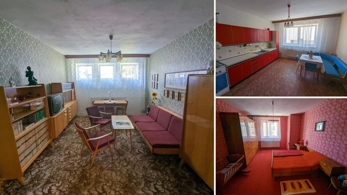
Collage of a period living room, kitchen and bedroom at Múzeum Vtedy in Prievidza
Photo: codnes.sk (Slovak)
Prievidza / Galéria Jabloň

Múzeum Vtedy

≈ 3.7 km · straight-line distance from the castle

Step into everyday life in the second half of the 20th century: a period shop, school, telephones, radios and record players. Explore a fully furnished 1970s–1980s flat, a television studio with historic cameras and control equipment, and the Kino Baník retro cinema with period seating and projection technology.

Galéria Jabloň, M. Falešníka 6, Prievidza. Check current opening hours and admission before visiting; call the museum on +421 905 815 555.

Retro museum · period flat · television studio · Kino Baník
Illustration of a glassblower’s pipe and a glass vase
Illustration · information from the operator
Valaská Belá / Valaská Belá 20

Sklený sen glassmaking open-air museum

≈ 18.0 km · straight-line distance from the castle

How is glass blown? Discover traditional tools at the glassmaking museum in Valaská Belá and arrange to watch a glassmaker at work. A glassmaking course is offered separately; check availability in advance.

Live demonstrations take place when the furnace is lit. Arrange your visit and check course availability with the operator in advance; telephone +421 907 198 433.

Glassmaking heritage · visits by arrangement

At wetlands, keep to accessible paths and respect restrictions; these places are not listed as swimming sites. Archived invitations and reports do not confirm current service or event availability.

Upper Nitra has more to discover.

We will keep adding ideas for outings. Have a favourite place? Let us know.

Send a tip to info@codnes.sk